Tuesday Storm Recap
- inglisbri
- Feb 14, 2024
- 1 min read

Here is a link to the NWS LWX office snowfall reports - There is an interactive map and snowfall listings across Maryland - https://www.weather.gov/lwx/pnsmap?type=snow
Below are two images which show the comparison between what actually accumulated (Left) and what I had forecasted (Right) . The Actual Snow fall map is based off the NWS snow reports linked above.
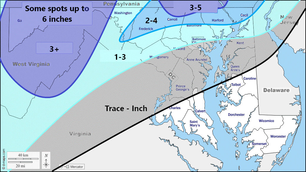
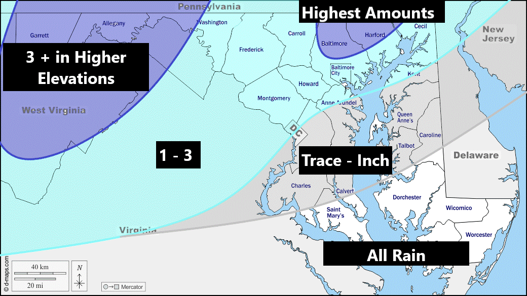
The storm did seem to behave as I expected. And higher amounts were in the same general area that I had forecasted!


Comments